Flood protection project to handle flows 30% higher than 2022 flood levels
24 March 2026
A flood mitigation project along the Maitai River beside Hanby Park, due to get underway this month, will allow this section of the river to manage peak flows that are 30% higher than the highest level seen in the August 2022 weather event.
“In the August 2022 weather event there were three sources of flooding,” says Nelson City Council Activity Engineer Flood Protection Toby Kay.
“The stopbank overtopped, a number of culverts under the stopbank back-flowed due to high river levels, and there was overflow from the Cleveland Terrace stormwater intake.”
Since then, Council has worked to address each of these issues. In mid-2025, the Cleveland Terrace stormwater intake was upgraded with a new pipe and inlet structure.
New flap valves were also installed in the culverts under the stopbank to manage backflow.
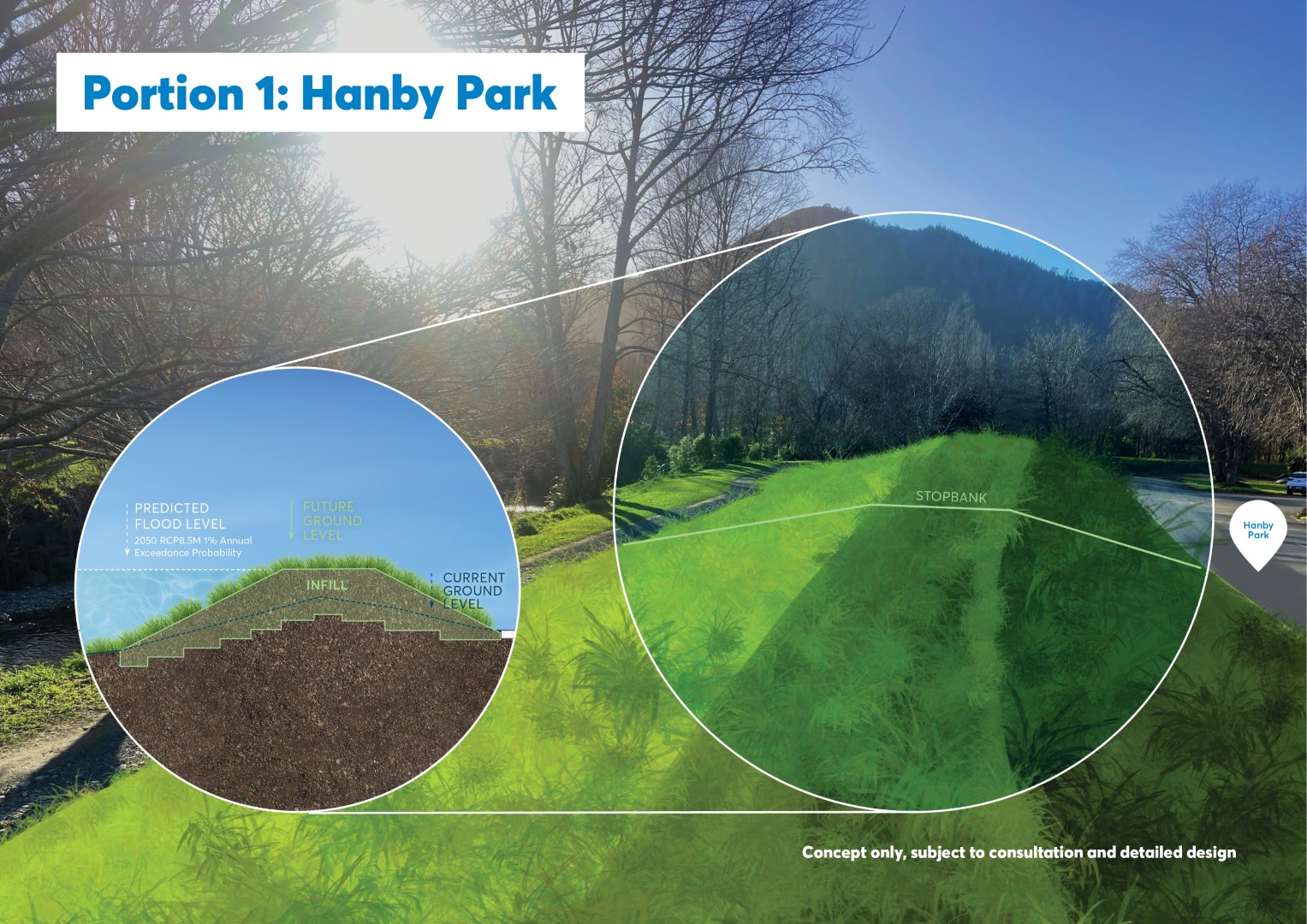
The latest works are the next piece of the puzzle and will involve a combination of stopbanks and floodwalls designed to manage peak flows of around 380 cubic metres per second (the equivalent of an olympic swimming pool every 6 seconds!) — almost 30 percent higher than the flow recorded during the 2022 event.
Detailed flood modelling for the work has been carried out by Tonkin + Taylor.
“They assess rainfall events under different climate change scenarios to ensure the infrastructure can withstand floods of that magnitude,” says Tonkin + Taylor Principal Planner Sara McMillan.
“Typically, these projects are designed for a one-in-100-year flood — meaning a flood that has a one percent chance of occurring in any given year. There are two main types of flood improvement works. The first gives the river more space by increasing the capacity of the channel, making it wider or deeper. That can be difficult to achieve in developed areas.”
The Maitai Flood Mitigation Project will focus on the second option: forming a barrier along the riverbank.
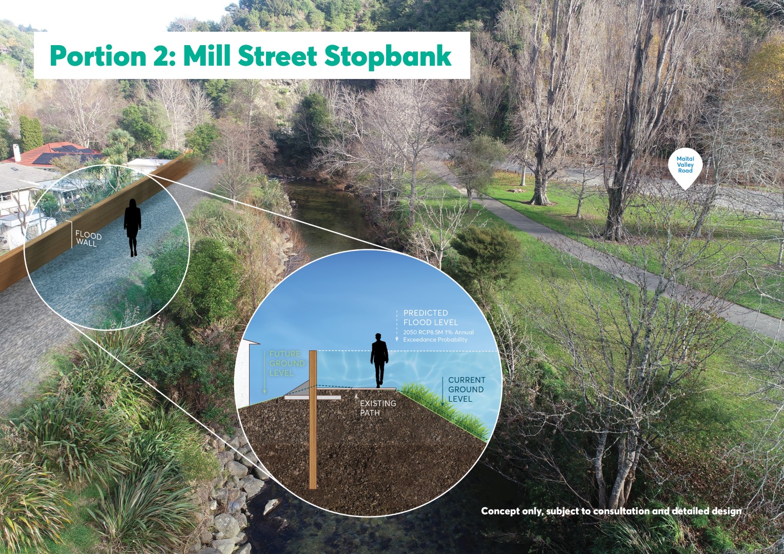
“A stopbank is an earth embankment built along the riverbank, essentially creating a barrier to hold back the river,” says Sara. “A floodwall is built on top of an existing stopbank using very strong materials and deep piles that anchor it to the ground, allowing it to withstand the immense forces of a river in flood.”
The area behind Hanby Park was first developed in the late 1940s and early 1950s and has experienced large floods in the past.“In 1954, a major flood inundated around a dozen homes in the area,” says Toby.
Other significant floods occurred in 1970, 1986, and a smaller event in 1995.
Following the 1954 flood, Council installed a stopbank behind Hanby Park, Mill Street and down to Clouston Bridge. This stopbank has provided protection during most flood events since then.
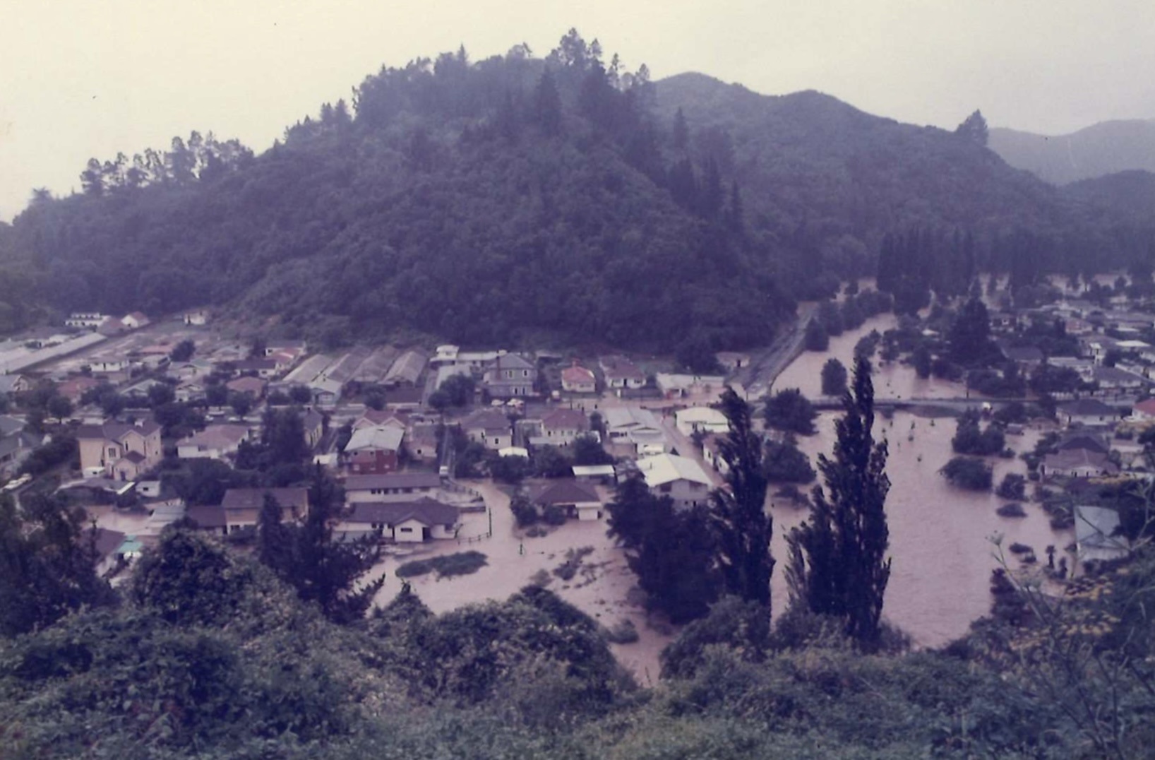
Maitai Valley flood - 1990s
Over the next 16 months there will be periods of construction along the riverbanks, including the use of heavy machinery. Hanby Park will be closed for part of this time, and temporary pedestrian and cyclist diversions will be in place.
Some trees and vegetation will need to be removed to allow construction. This work will be carefully managed to protect local wildlife.
“We know there are protected northern grass skinks living along the river margins,” says Sara.
“Ecologists will be undertaking a programme to collect these skinks and relocate them to a safe nearby habitat.” says Sara.
An ecological planting plan is also being developed to revegetate the areas affected by construction.
The project will be delivered in five stages and is expected to be completed by July 2027. It has a total budget of $9 million, with $5.4 million funded through the Central Government’s Regional Infrastructure Fund which is administered by Kānoa – Regional Economic Development & Investment Unit.


