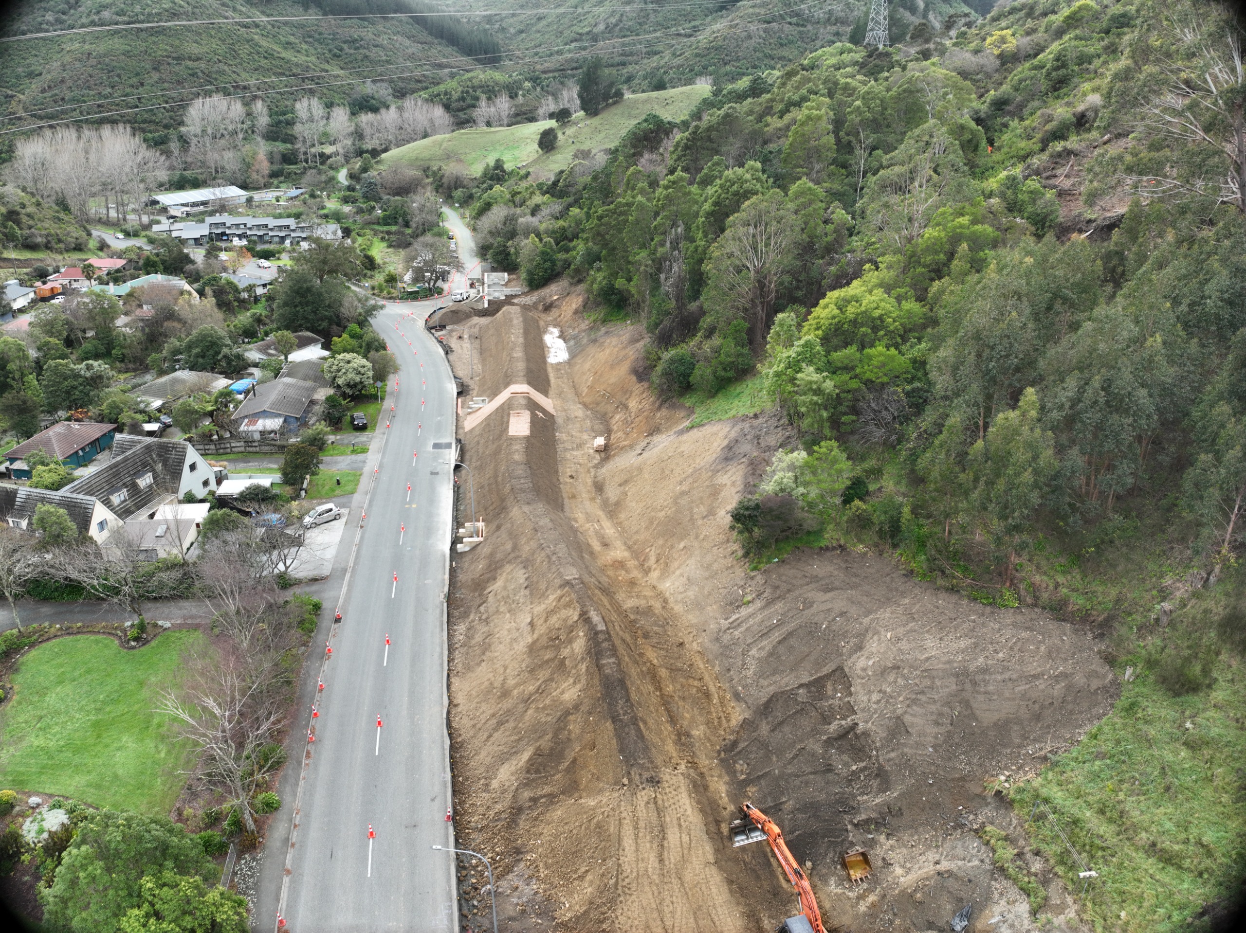
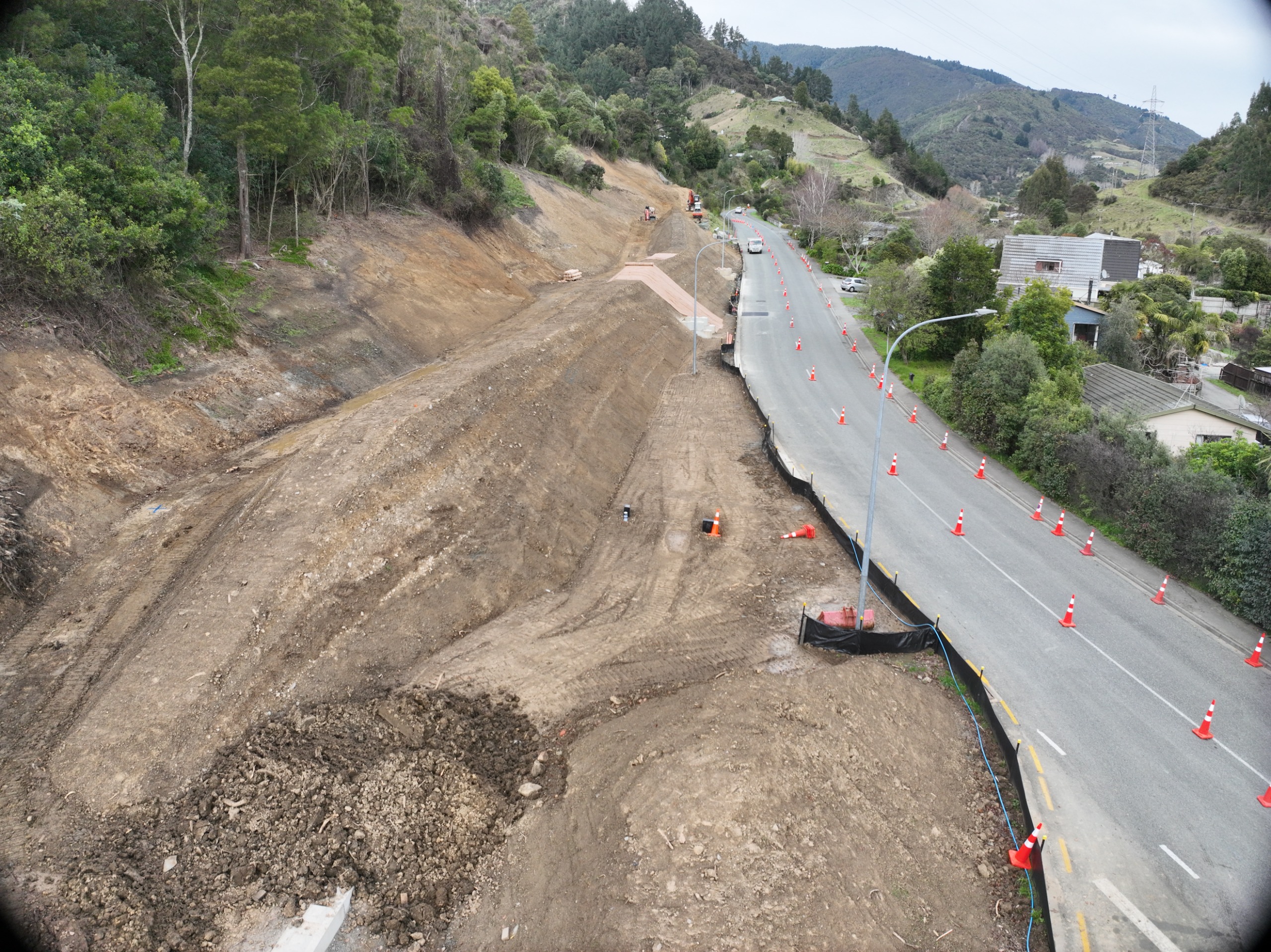
Constructing the bund
Now the final house from The Brook has been removed, the project to mitigate the significant upslope land instability hazards is moving to the final stage of work, constructing the large earthen bund with upgraded stormwater controls .
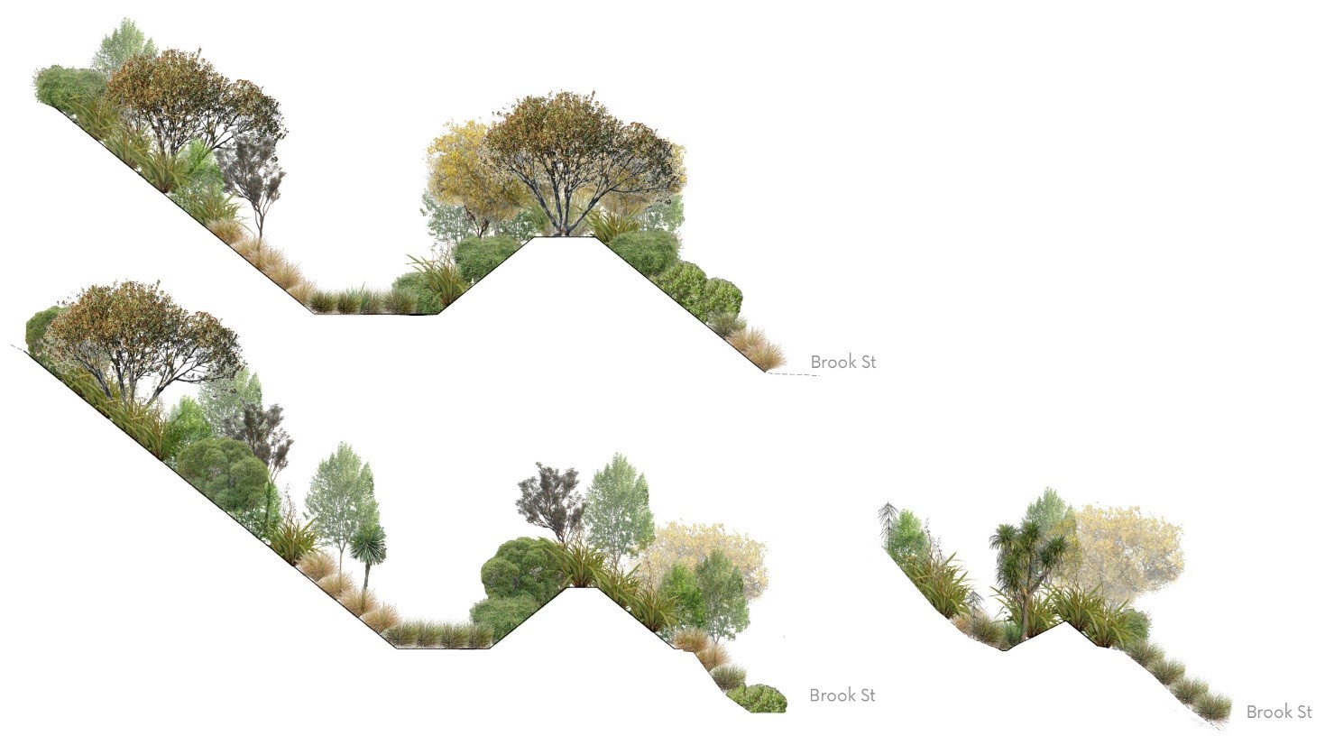
What is a bund?
The bund is designed for the controlled capture future landslip debris, and to channel stormwater runoff flows from the hillside above into the new network intake structures. Once constructed the bund and stormwater upgrades will provide protection to the road, road users, infrastructure within the road and the Brook waterway.
What will be happening onsite?
Tantragee Road Stormwater intake:
Designed to capture all the stormwater coming down the gully and from the first section of the swale behind the bund, with improved sediment controls. Codgers Park will remain accessible at all times.
This part of the project will be expected to take six weeks.
Decommissioning:
Initial work is to decommission the stormwater and sewer pipes that services the houses.
There will be a lane closure in place with traffic controlled via traffic lights.
Vegetation and infrastructure removal will take approx. four weeks to complete. There will be noise with concrete crushing onsite between 9:00am – 3:00pm.
Earthworks:
Mid-April to late-June the earthworks to build the bund will be completed in sections. Across the month of May, a new stormwater intake structure and piped network connection will be installed next to the berm, capturing stormwater from the second section of the swale.
In mid to late July, Kumanu will undertake the planting of the bund.
June 2026 update
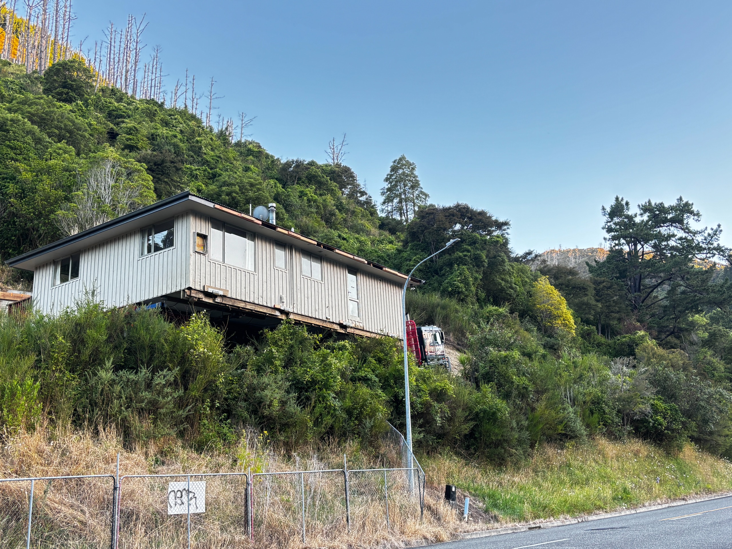
1 February 2026, the final house is relocated
The Why:
Following the August 2022 severe weather event, a number of slips were identified on Council owned land.
These were assessed, and investigation work got underway to determine if remediation was required.
A subsequent weather event in May 2023 resulted in a much larger area of unstable land being identified above some houses in the Brook.
To mitigate this risk in a cost-efficient way, Council decided to purchase 10 affected properties so that the houses could be removed. This removal and subsequent mitigation work would reduce the overall risk both Council assets and other private properties in the Brook.
The houses on the identified properties have been sold, and now Council is talking with the house removal companies on how best to move these structures to their new locations.
The Plan:
The removal specialists have come up with a plan, which will involve splitting some houses into multiple pieces and transporting along a route out of the Brook.
There are 10 buildings that will be shifted, with some requiring the move in two parts, there could be up to 15 movements to successfully relocate the properties.
Council can confirm that residents' access will be maintained throughout each move with small delays as they navigate specific streets. During periods when the truck or crane needs to load from the road, a two-way stop/go system will be in place.
All properties will be moved after 8 pm, and the final date for removal is February 2025.
The route will move down Brook Street, against the flow of traffic. Pilot vehicles will travel ahead of and behind each truck, detouring residents across the link bridges and down Westbrook Terrace as they navigate each section of Brook Street. There will be minimal delays as they manage traffic from both sides. Please follow on-street instructions from the pilots.
Once the trucks arrive at Nile Street, they will turn right onto Nile Street towards Tory Street. They will then travel along Tory Street, Milton Street and then onto Bridge Street. From Bridge Street they will continue onto Collingwood Street, towards Halifax St and then Rutherford Street. From here each removal will have an individualized plan depending on where they are traveling to.
Residents vehicles:
One of our priorities during the relocation of these houses is communicating with residents along the route. There will be two main forms of communication. The removal specialists will letter drop the route ahead of each move. Council will send out reminders through Antenno. Antenno is an app (available for Android and Apple) that will deliver a notification directly to your phone. All you need to do is select your neighbourhood.
It would be appreciated if residents could please move their vehicles off the street while the houses are being relocated. Along the route there are pockets where vehicles could cause challenges and delays, which could require vehicles to be towed. To ensure that each movement is efficiently and without challenges we would appreciate your input.


